- Catch-Up
14 May 2026
Online
free
Landscape Observatory: AI Mapping for Protected Landscapes
Learn about the scope and development Landscape Observatory, an AI mapping project from the Protected Landscape Partnership.
The presentation focuses on the AI mapping workstream of the Landscape Observatory project, which combines high-resolution aerial imagery with advanced machine learning to allow a deeper understanding of surface detail.
The team shares their latest AI research, which will create the most detailed landscape intelligence system ever created for the Protected Landscapes.
Monitoring landscape change in a repeatable and accurate manner has historically been expensive and time-consuming. Rapid advances in artificial intelligence (AI) are enabling us to automate landscape monitoring, opening up a range of possibilities in conservation work.
Landscape Observatory has been recognised in the Government’s Land Use Framework for England as an innovative project which is contributing to ‘making land digital’ and helping to reform data tools and decision-making systems.
The core team are based at the Peak District National Park and work in collaboration with specialists from Cranfield University to deliver the Landscape Observatory project workstreams:
- Mapping a detailed landscape intelligence system through high-resolution aerial images and cutting-edge AI.
- Monitoring habitats, land use, and cultural heritage features.
- Managing the impacts of climate change through Adaptive Management plan practices.
 Free
Free 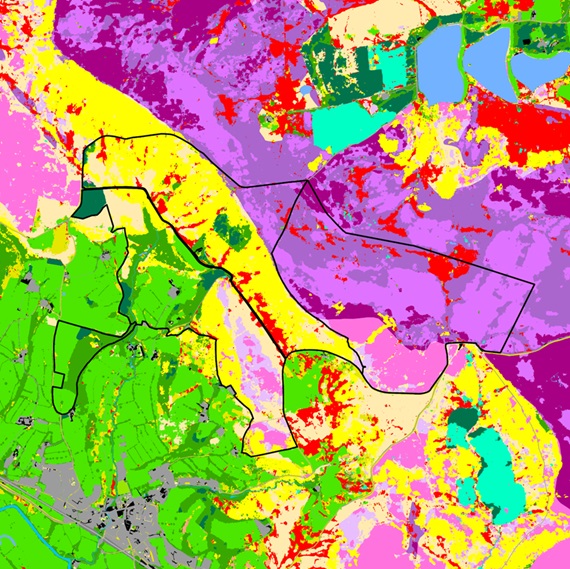
 Watch
Watch Browse more Events

30 Jun 2026
Online
What does spatial planning mean for major infrastructure & place responses
1 video

Access all recordings, excluding premium content on Campus for 12 months
 View Pricing
LI Campus sponsored by